
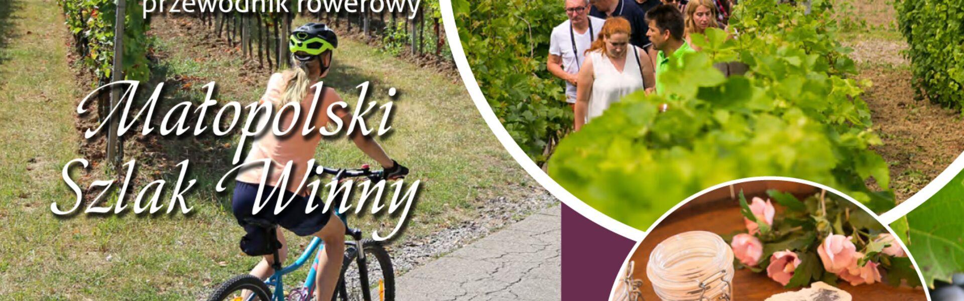
By presenting this guide created by the Gorce Tourist Organisation, we would like to encourage everyone to combine cycling with discovering the vineyards of Lesser Poland. All tours are, of course, traced within the Małopolska region and have been designed to run close to the vineyards along the Małopolska Wine Route; moreover, they have the form of 30–40 km closed loops.
A PDF version of the entire guide to download / GPX packet of all traces to download
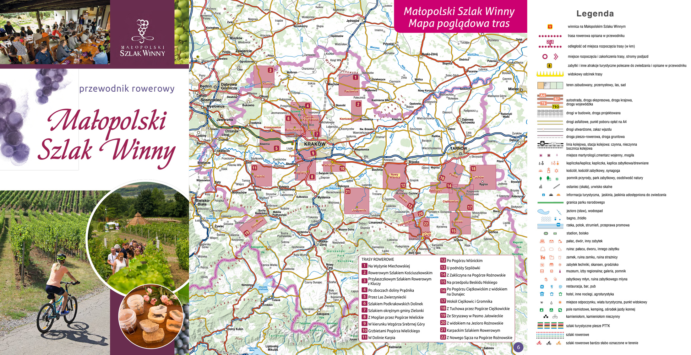
Underneath the map, there's also a list of tours with description and a tourist map (each in a separate PDF file) together with the corresponding GPX tracks. Below is an overview map with the location of the vineyards of the Małopolska region and the cycling tours presented here (in blue), together with the VeloMałopolska cycling route network (in purple)
Lista wycieczek na Małopolskim Szlaku Winnym do pobrania:
- (średnia) Na Wyżynie Miechowskiej (Janowiczki) 35 km / GPX
- (średnia) Rowerowym Szlakiem Kościuszkowskim (Koniusza) 32 km / GPX
- (trudna) Przylaszczkowym Szlakiem Rowerowym z Kluczy (Klucze) 41 km / GPX
- (średnia) Po zboczach doliny Prądnika (Prądnik Korzkiewski) 36 km / GPX
- (średnia) Przez Las Zwierzyniecki (Krzeszowice – stacja PKP) 38 km / GPX
- (trudna) Szlakiem Podkrakowskich Dolinek (Bolechowice) 21 km / GPX
- (trudna) Szlakiem okrężnym gminy Zielonki (Zielonki) 32 km / GPX
- (trudna) Z Mogilan przez Pogórze Wielickie (Mogilany) 31 km / GPX
- (łatwa) W kierunku Wzgórza Srebrnej Góry (Tyniec) 29 km / GPX
- (trudna) Grzbietami Pogórza Wielickiego (Wieliczka) 25 km / GPX
- (trudna) W Dolinie Karpia (Woźniki) 42 km / GPX
- (trudna) Po Pogórzu Wiśnickim (Nowy Wiśnicz) 38 km / GPX
- (trudna) U podnóży Szpilówki (Iwkowa) 26 km / GPX
- (trudna) Z Zakliczyna na Pogórze Rożnowskie (Zakliczyn) 27 km / GPX
- (trudna) Na przedpolu Beskidu Niskiego (Pleśna) 29 km / GPX
- (trudna) Po Pogórzu Ciężkowickim z widokiem na Dunajec (Pleśna) 37 km / GPX
- (trudna) Wokół Ciężkowic i Gromnika (Ciężkowice) 35 km / GPX
- (trudna) Z Tuchowa przez Pogórze Ciężkowickie (Tuchów) 34 km / GPX
- (trudna) Ze Stryszawy w Pasmo Jałowieckie (Stryszawa) 26 km / GPX
- (trudna) Z widokiem na Jezioro Rożnowskie (Tęgoborze) 22 km / GPX
- (trudna) Karpackim Szlakiem Rowerowym (Jodłownik) 36 km / GPX
- (trudna) Z Nowego Sącza na Pogórze Rożnowskie (Nowy Sącz) 30 km / GPX
Most of the tours pass through the Wieliczka, Wiśnica, Rożnów and Ciężkowickie Foothills and the Kraków-Częstochowa Upland. But there are also routes mapped out in other areas of the voivodeship: in the Miechów Upland, the Żywiec Beskid, around Nowy Sącz and even in Kraków. These regions are characterised by varied relief, significant elevation above the valley bottoms, steep slopes, i.e., all the terrain features that are most conducive to viticulture. Are they also beneficial for cyclists? Certainly, the cycling routes led there may be quite demanding due to the necessity to overcome steep and long ascents (most of the tours are of ‘medium’ and ‘difficult’ category). However, this should not be discouraging. The hardship endured will be compensated by the opportunity to admire the magnificent landscapes, usually surrounding the Małopolska vineyards. Another element adding special charm to the surroundings are osier vine plantations spilling picturesquely over the undulating surface of sunlit slopes. Finally, a visit to the vineyards is an attraction in itself.
The assumed distance of each tour will be sufficient for a leisurely one-day trip combined with visits to numerous tourist attractions. We have designed all the routes as closed loops, with the starting and finishing points of the tour at locations that are easily accessible by public transport, with the possibility of leaving the car. As far as possible, we routed them along existing cycle routes. Unfortunately, their marking in the field is often incomplete. Therefore, to make it easier for you to find your way around, we have presented all the routes described in the guidebook on tourist maps. We have placed a dense network of kilometre points on them, giving next to each of the point the distance from the starting point. Most of the routes run on asphalt or paved roads, almost exclusively with low car traffic. We wish you satisfaction from cycling the Małopolska Wine Route!
Originator and implementer of the Małopolska Wine Route:
Gorce Tourist Organisation
Kamienica 467, 34-608 Kamienicawww.visitkamienica.pl
The project was carried out with the financial support of the Małopolska Voivodeship